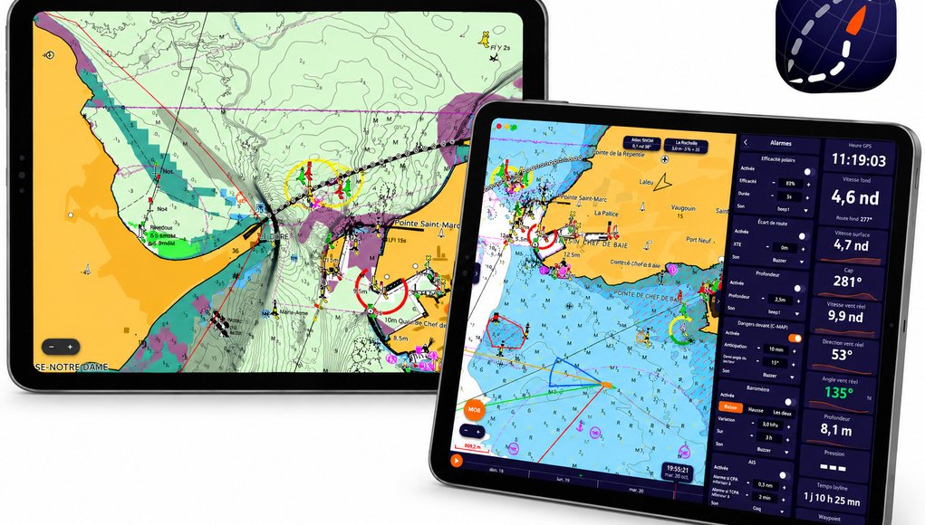
NavimetriX, the weather-routing and navigation app for iOS, Android, Windows and macOS, can now use C-MAP’s latest charts. Only the “X” generation works: DISCOVER X and REVEAL X, bought as a C-MAP Digital License. Older C-MAP charts (DISCOVER or REVEAL without the X, 4D, MAX) do not, so check for the X before you buy.
What’s new
- C-MAP charts in the app, with day and night styles and offline downloads. REVEAL X adds satellite imagery, shaded relief, vegetation and seabed-hardness layers on top of DISCOVER X.
- C-MAP AutoRouting draws a chart-aware route around land and shallows using your boat’s draft and air draft. NavimetriX is clear that this is navigation assistance, not weather routing, and it needs downloaded C-MAP zones covering every route point.
- Weather routing with chart safety: with a C-MAP chart, routing can avoid shallows and restricted areas, keep a set distance from dangers and pass cardinal marks on the correct side.
- Hazards Ahead alarm watching a sector in front of the boat.
NavimetriX lists example Central and West Europe prices (22 September 2026) of EUR 159 for DISCOVER X and EUR 249 for REVEAL X for the first year, with later years at half price.
Our take
Chart-aware routing in an app that already does good weather routing is a genuinely useful combination for cruising sailors. But treat AutoRouting as a first draft: check every leg yourself on the chart, and remember that NavimetriX itself warns not to feed an AutoRoute into a weather routing because it has too many waypoints.
If you want live instrument and AIS data in the app, an NMEA 2000-to-Wi-Fi gateway such as Digital Yacht’s NavLINK is one way to do it.
Sources
- NavimetriX: Which C-MAP charts work?
- NavimetriX: C-MAP AutoRouting guide
- NavimetriX: Coastal routing with C-MAP charts
- Digital Yacht News, 22 Oct 2026
Image: Digital Yacht / NavimetriX